


Russell Township Voting District, Russell County, Kansas
About
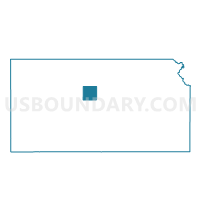
Outline

Summary
| Unique Area Identifier | 586589 |
| Name | Russell Township Voting District |
| County | Russell County |
| State | Kansas |
| Area (square miles) | 49.24 |
| Land Area (square miles) | 49.23 |
| Water Area (square miles) | 0.01 |
| % of Land Area | 99.98 |
| % of Water Area | 0.02 |
| Latitude of the Internal Point | 38.91494490 |
| Longtitude of the Internal Point | -98.83142230 |
Maps


Graphs
Select a template below for downloading or customizing gragh for Russell Township Voting District, Russell County, Kansas


Neighbors
Neighoring Voting District (by Name) Neighboring Voting District on the Map
- Big Creek Township Voting District, Russell County, KS
- Center Township Voting District, Russell County, KS
- Grant Township Voting District, Russell County, KS
- Paradise Township Voting District, Russell County, KS
- Russell Ward 1, Russell County, KS
- Russell Ward 2, Russell County, KS
- Russell Ward 3, Russell County, KS
- Russell Ward 4, Russell County, KS
- Russell Ward 4 Exclave, Russell County, KS
- Russell Ward 4 Exclave Airport, Russell County, KS
- Waldo Township Voting District, Russell County, KS
Top 10 Neighboring County Subdivision (by Population) Neighboring County Subdivision on the Map
- Russell city, Russell County, KS (4,506)
- Big Creek township, Russell County, KS (479)
- Center township, Russell County, KS (221)
- Grant township, Russell County, KS (186)
- Paradise township, Russell County, KS (166)
- Russell township, Russell County, KS (82)
- Waldo township, Russell County, KS (78)